| St Mary Bourne to Ibthorpe |
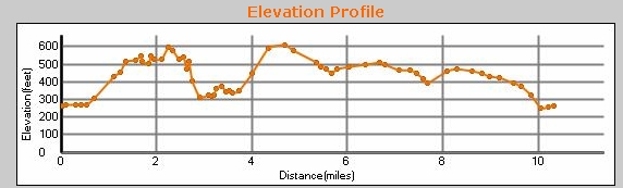
11 miles, circular. Actually, it turned out to be 12.5 for us, due to a couple of navigation errors. Starting to get some serious hills now--we recorded over 1200 ft--(but not as serious as the next walk!). There's an excellent parking place at the recreation ground car park at St Mary Bourne. From there head forward and right towards the pavillion to find the Test Way. We followed the path between the two wooden fences till we got to Ibthorpe, and then looped round Horsehoe Lane. That meant we missed Dolman's Lane, and after a sit on the seat at the end of Horseshoe Lane, went up Windmill Lane. Steep! And added some miles. But our serious error was here. Instead of turning east along the north edge of the wood, we went south on the track, which meant that we then had to walk north on the main road. And why did we make the mistake? Because I had forgotten to charge the battery ont he SatMap, and because when printing out the map, I'd missed off this corner. It's all obvious now, looking at the map, but with no map, and no GPS, it was easy to make the mistake! Park on the red circle below, and either load the GPX file into your GPS, or follow the TW signs. You can scroll the map below simply by moving the mouse with the left-button held down.
|
|
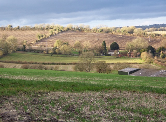
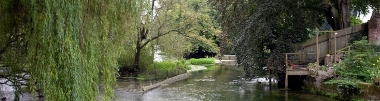
© Copyright Trish Steel and licensed for reuse under this Creative Commons Licence
See other pictures of this area here.
To download GPX Files, right-click the link, choose Save Link As ..., and save it to wherever you keep route files.
See the documentation that came with your GPS for information on how to download the route to your GPS.
These are a selection of Ordnance Survey Maps that cover this walk.
Geocaches on route
No Geocaches on this section
There are caches nearby: see them on Google Maps.